Some projects start with a plan. This one started with a question on a forum.
Earlier this month a Gauge 1 modeller posted on the Templot Club forum asking whether Templot might be able to crate 3D printable track for a model of NYC’s elevated railway system. Templot is great, but currently only produces Bullhead track work. A suggestion was that TrackIT!, my British flat-bottom trackwork generator, might be able produce the required components.
The honest answer however, was no. TrackIT! is built round British switch and crossing geometry from official drawings, and a Manhattan el is a different animal: open timber ties on a steel deck, guard timbers, walkways, a third rail on insulator pots, all carried on lattice girders and iron columns high over the street.
It was too good a subject to let go though. So instead of bending TrackIT! out of shape, I started a separate application and ElevateIT! was born. This post covers where it came from, what it can do today, and where it could go next. I hope it tempts a few more people into modelling one of the most extraordinary railways ever built.
A railway in the sky: the Manhattan els in brief
By the 1860s Manhattan’s streets were choked with horse cars, omnibuses and carts. In 1868 Charles T. Harvey opened a demonstration line along Greenwich Street: a single track on a row of slender iron columns, with the cars hauled by cable. The cable machinery was a constant headache and the company soon failed. Its successor, the New York Elevated Railroad, put small steam locomotives on the line in 1871. It became the Ninth Avenue El.
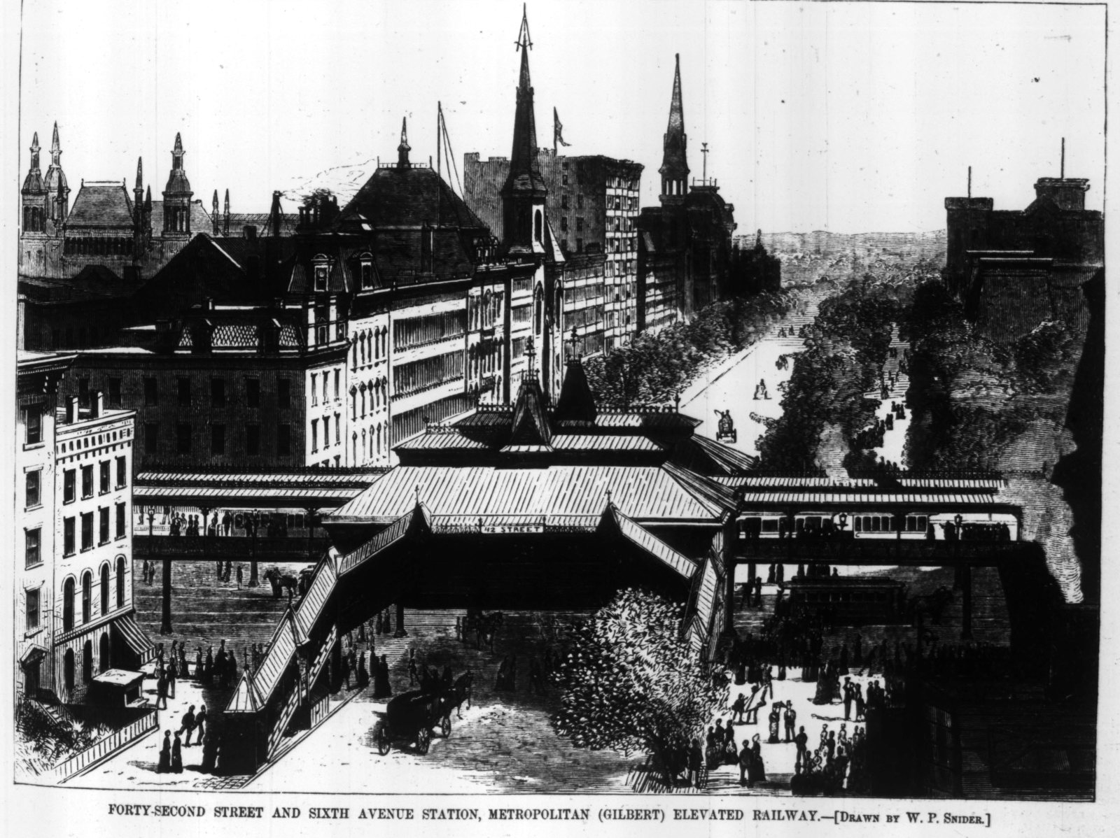
Then the idea took off. Dr Rufus Gilbert’s Metropolitan Elevated Railway opened on Sixth Avenue in 1878. By 1880 four lines ran the length of the island, on Second, Third, Sixth and Ninth Avenues, and all four were run by one lessee, the Manhattan Railway Company. Trains of wooden cars were hauled by little Forney tank engines, built to take curves of about 100 feet radius. At the busiest stations they ran every couple of minutes.
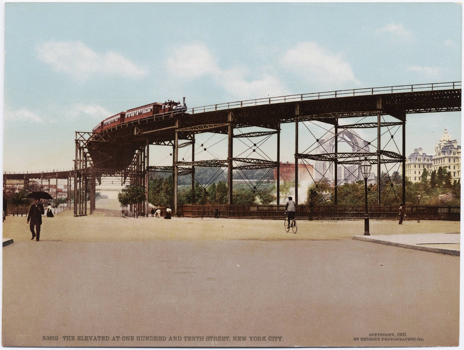
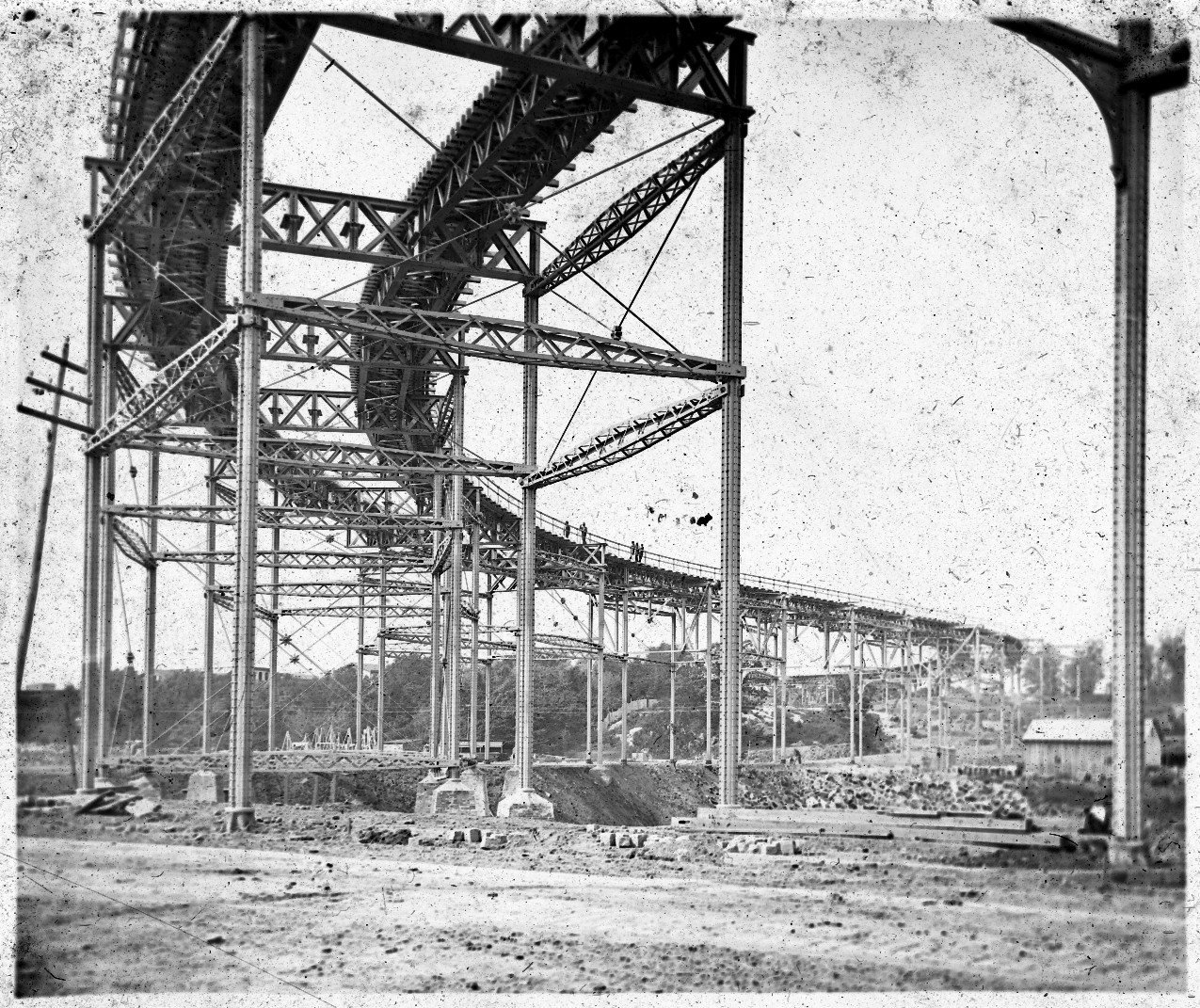
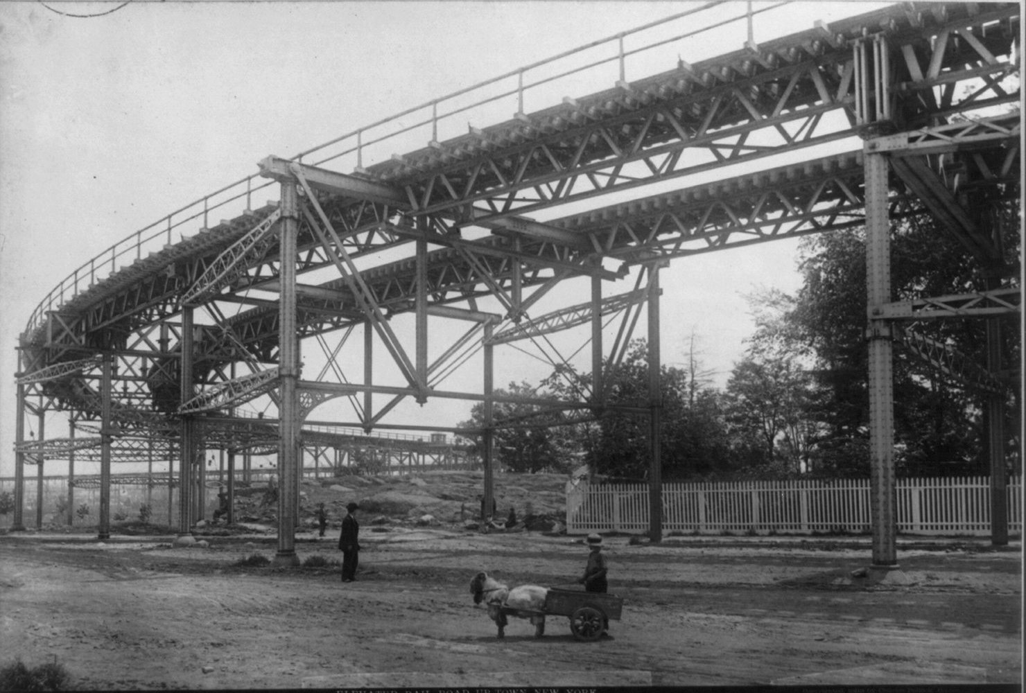
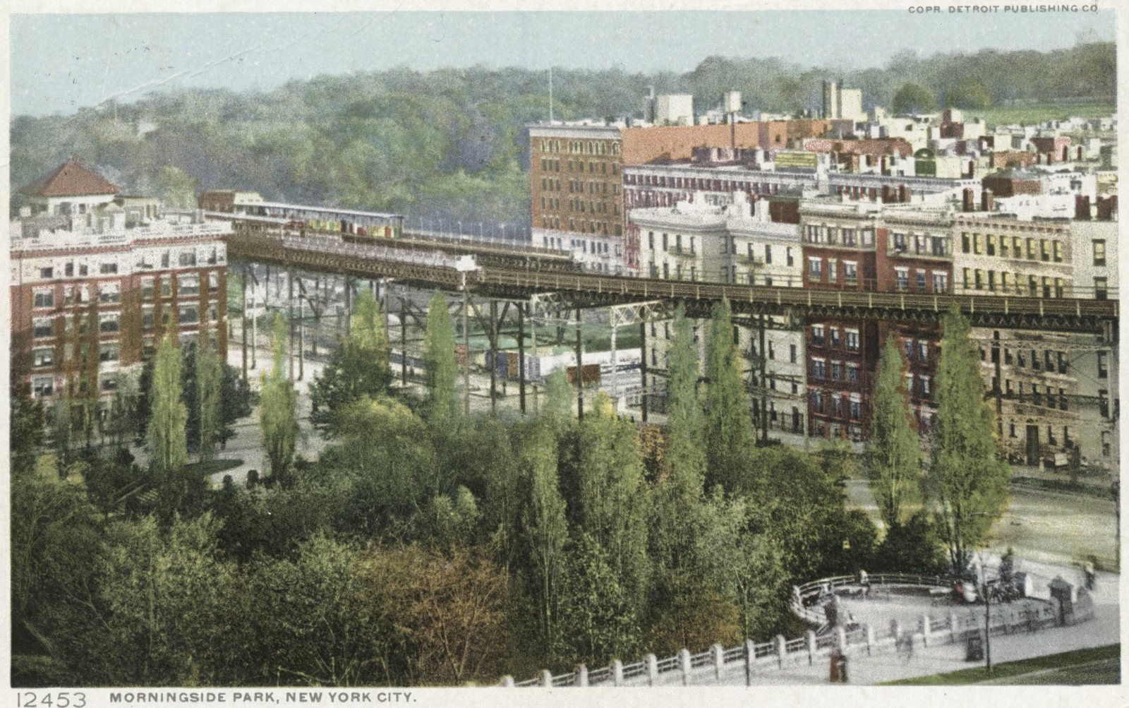
The engineering was remarkable, nowhere more so than at 110th Street. Here the Ninth Avenue line swung from Columbus Avenue onto Eighth Avenue through a reverse curve carried on iron towers. The rail stood about 59 feet above the pavement, and the curve radii were printed at 354 and 378 feet. New Yorkers called it the “Suicide Curve”. In 1879, before the timberwork went on, the bare towers looked like this:
Electric traction arrived between 1901 and 1903, and the Interborough Rapid Transit Company (IRT) leased the whole system in 1903. The els’ last great upgrade came with the Dual Contracts of 1913. The lines were third-tracked for express trains, stations were rebuilt with island platforms, and in 1918 the Ninth Avenue line was carried over the Harlem River into the Bronx on the old Putnam Bridge. That is the structure ElevateIT! models: the Dual Contracts standard of about 1916.
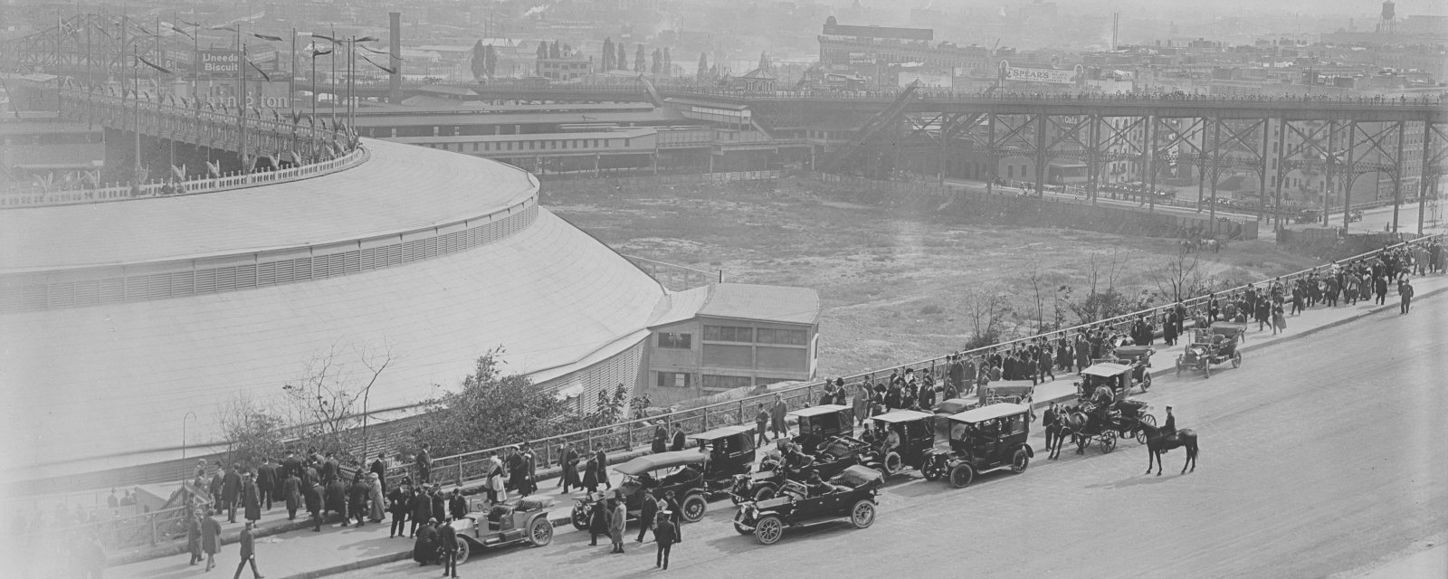
At the north end of Manhattan the Ninth Avenue El finished at 155th Street, right beside the Polo Grounds, home of the New York Giants. On game days it moved enormous crowds. Behind the grandstand a storage yard on elevated structure fanned out towards the river, and it was packed with el cars.
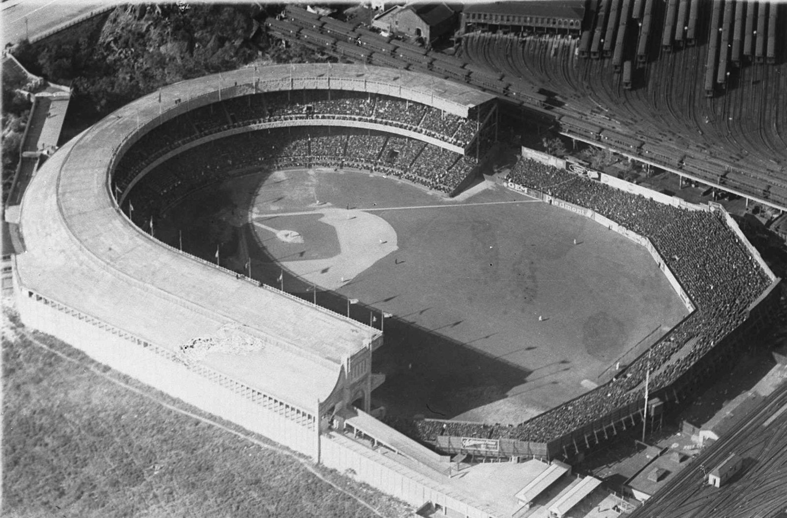
The subways that followed doomed the els. Sixth Avenue closed in 1938. The Ninth Avenue line south of 155th Street closed on 11 June 1940, and Second Avenue in 1942. Third Avenue, the last el in Manhattan, went in May 1955. A stub survived at the top of the island as the Polo Grounds Shuttle, running from 155th Street across the Putnam Bridge, until 31 August 1958. Almost nothing of the Manhattan els survives today. For most of us, the only way to stand on one again is to build it.
What ElevateIT! is
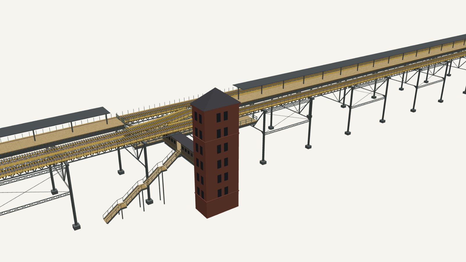
ElevateIT! turns the prototype drawings into parts you can print and cut. It starts from the railway’s own engineering records, above all the 1918 Transactions of the American Society of Civil Engineers paper on the Manhattan Elevated improvements and its dimensioned track and deck section. From those it generates the deck: ties, tie plates, rails, guard timbers, walkways, handrails and the third rail on its insulator pots. It can also generate the ironwork underneath and the stations on top.
Everything is held as prototype dimensions and only scaled when you export, so the same design builds in Gauge 1 (1:32), G (1:24), O (1:43.5 and 1:48), OO (1:76.2) or HO (1:87.1). Every dimension is tagged with where it came from: measured off a drawing, stated in a text, scaled, derived, or openly provisional. You can always see how far to trust a number. More than forty automated check suites run behind it. They look for floating parts, clashing members, mirror-image exports and missing timbers.
The whole application is a single web page. It runs in an ordinary browser, works offline, and is small enough to email. It has three working modes.
1. Plan: find the real railway
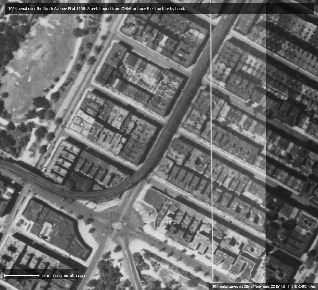
Plan mode puts historical mapping under your mouse. It uses New York City’s own 1924 aerial survey, taken while all four Manhattan els were still standing. It can also overlay the Bromley 1930 land-book plates, georeferenced continuously from West 105th to West 163rd Street, and import route lines from OpenHistoricalMap. You trace the structure off the photograph, and ElevateIT! fits a chain of straights, curves and transition curves to your clicks. Or you can trace the straights yourself and drop a curve of your chosen radius into each corner. You can trace building frontages too, give each a storey count, and they appear beside the line in the 3D views.
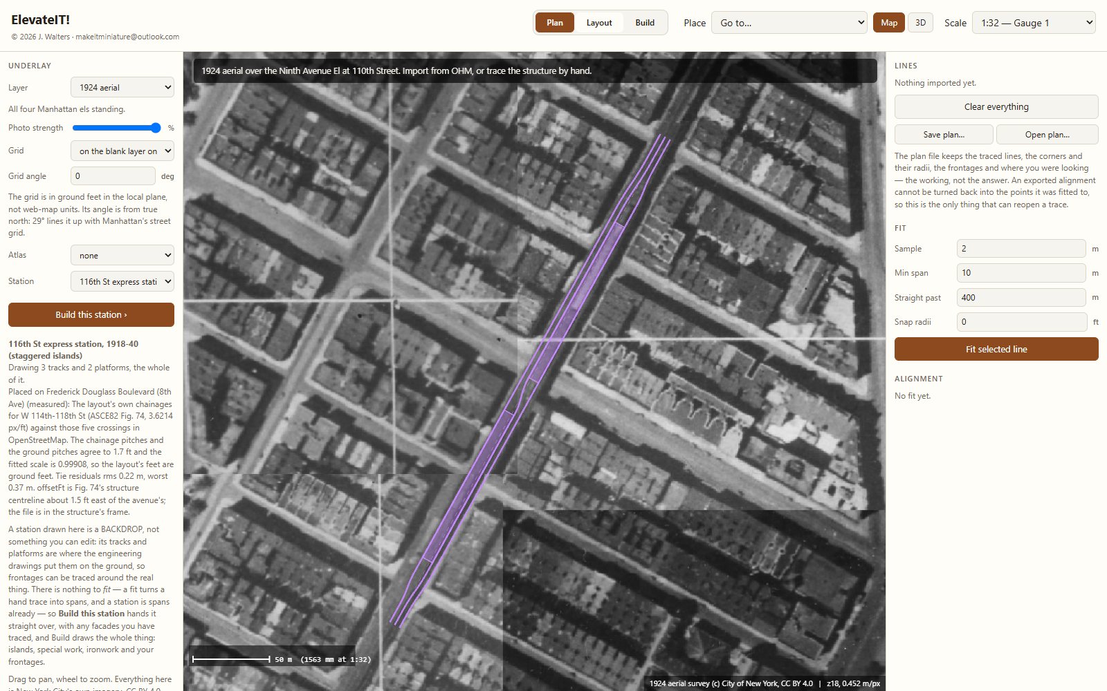
Prepared stations can be dropped onto the map where they actually stood. Below, the 116th Street express station, with its staggered island platforms, is placed on Eighth Avenue by matching its own chainages to five street crossings. It lands within a foot or two of the real line. One click sends it to Build mode.
2. Build: the model itself
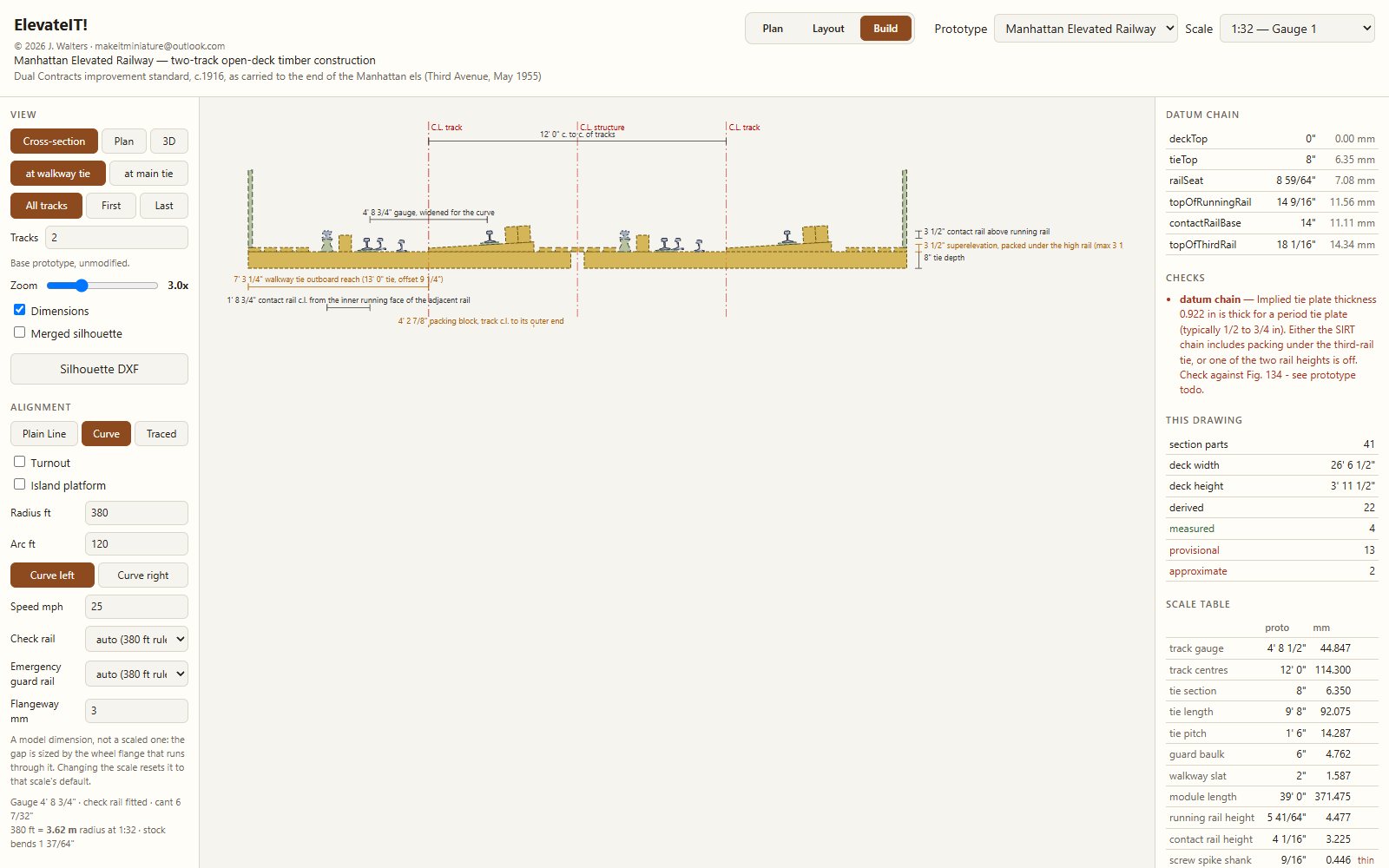
Build mode makes the parts. The railway is built in 39 ft modules, the length of a prototype rail, which comes to 371 mm in Gauge 1. You can view each module as a dimensioned cross-section, a plan or a 3D model. On curves you get what the prototype had: gauge widening, superelevation carried on tapered cant blocks under the high rail, and check rails and emergency guard rails where the radius calls for them.
Pointwork is where ElevateIT! goes well past plain track. It builds rapid-transit No. 6 turnouts with their switch timbers, slide plates, rods and machines, as well as crossovers, scissors crossovers, diamond crossovers and movable-point frogs. A general “routes” engine sits under all of these. Give it a list of tracks and connections and it finds every frog, acute and obtuse, and lays timbers, plates, walkways and third rail round them. That is how it can build a complete station throat.
The gentleman who had made his initial enquiry on the Templot Club forum is modelling 155th Street, so that station has had the most attention. ElevateIT! builds its 1918–40 layout from the ASCE general plan: two island platforms with canopies, the station house over the tracks, stairs, mezzanines and ticket offices, the yard track and buffer stop, the curve onto the Putnam Bridge, and both throats. That comes to 17 routes, 23 switches, 33 acute and 10 obtuse frogs over 1,482 ft of railway. The later 1940–58 shuttle layout is included as well.
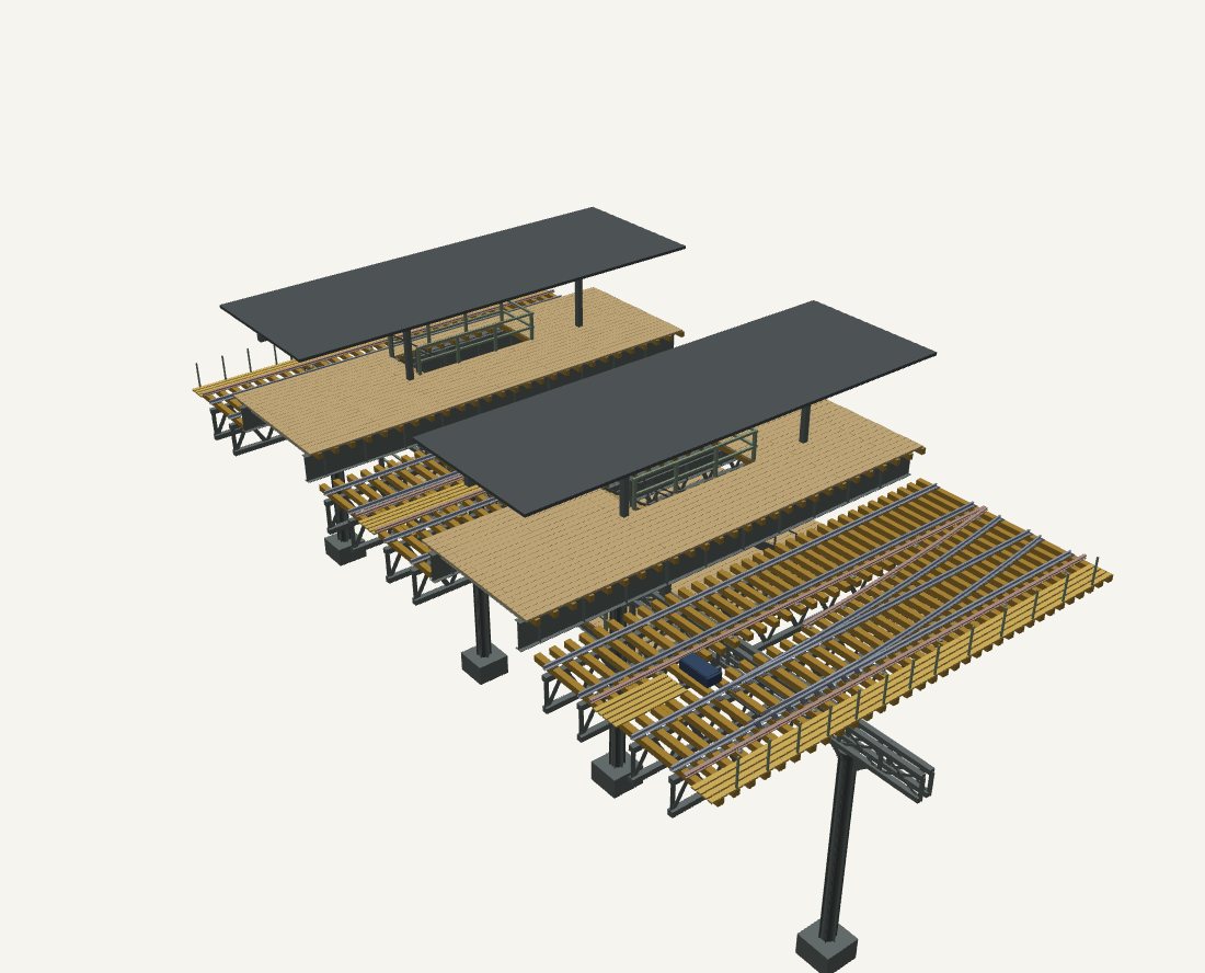
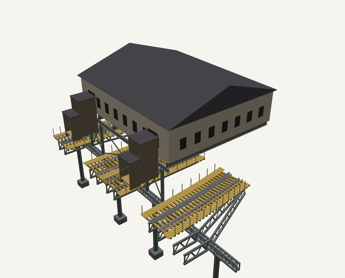
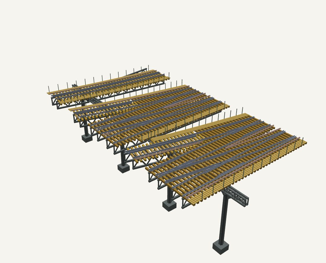
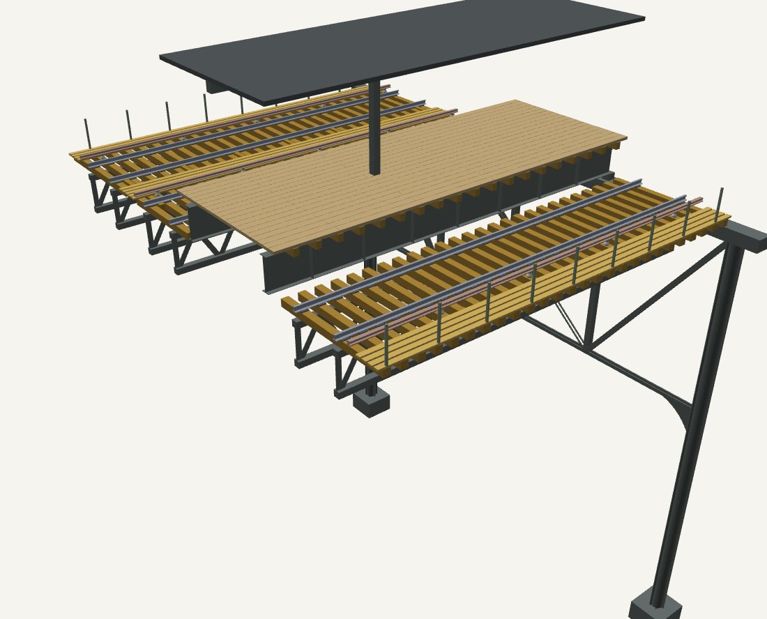
Under the deck, ElevateIT! currently models three structure types from the Ninth Avenue line: the tall towers of the 110th Street curve, the 20 ft deep cross-trusses of the Eighth Avenue high viaduct between 110th and 125th Streets, and the standard lattice cross-girder bent north of there. The girders spread out to carry whatever tracks run above them.
What comes out is meant for the workshop:
- STL, OBJ and 3MF files for 3D printing, checked by reading the written file back in. We check the file, not the model in memory.
- DXF cut files for laser-cutting ties, walkways and structure parts, nested to the sheet.
- A tie-laying jig that holds every tie at its prototype spacing, fanned correctly on curves, plus a ladder fret.
- Cut lists and assembly drawings for each module.
3. Layout: design with kits
Not everyone wants to model a real location to the inch. Layout mode is a drag-and-snap canvas of kits for one, two or three tracks: straights, curves, crossovers, scissors, diamond crossovers, turnouts off the deck and an island-platform station. Each kit is a whole number of tie spaces, so kits join cleanly. Where a gap will not close, ElevateIT! designs a made-to-measure closure piece. It flags overlapping decks and special work placed too close to a curve. Where a straight meets a curve it adds run-out pieces automatically, so the cant builds up smoothly. When you are happy, it produces a numbered kit order and a full-size printed plan, tiled across A4 to A0 sheets with a check bar on each.
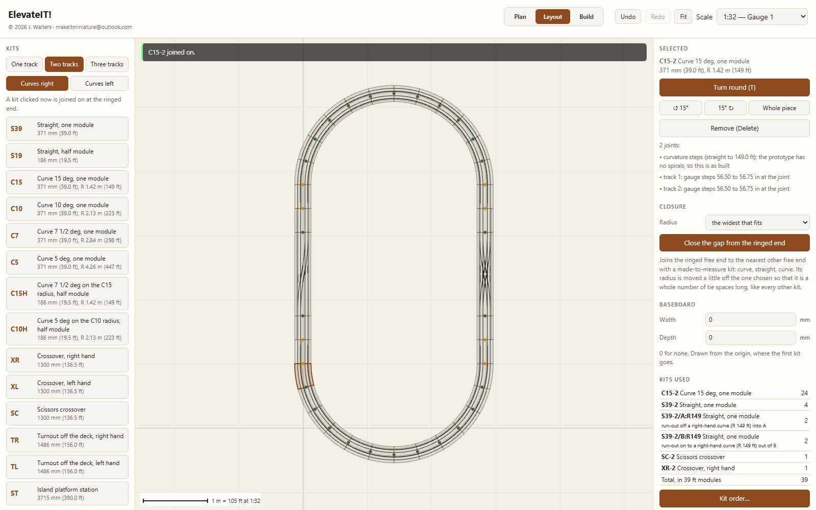
Any layout goes straight to Build mode, one module per kit, built exactly as the kit will be made.
Where it has got to
ElevateIT! is still in its infancy, and it will be a while before all of its potential becomes proven 3D printed parts. However, so far the following has been achieved:
- The plain-line deck, curves and transitions are complete. One to four tracks are supported, with BMT and later NYCT variants alongside the Manhattan standard.
- Turnouts, crossovers, scissors and diamond crossovers are built, along with a general routes engine for full station throats.
- Two prototype stations are done: 116th Street (1918–40) and 155th Street (1918–40, plus the 1940–58 shuttle). Both include platforms, canopies, stairs, mezzanines and street access.
- Three types of supporting ironwork are modelled.
- Plan mode can trace on historical mapping, and Layout mode has a complete kit system with printed plans.
I have tried to be honest about the gaps. Some turnout details are still representative rather than measured, because the definitive dimension tables are in a pay-walled AREMA publication I don’t yet have access to. The app says so wherever that applies. The original structural drawings survive, around 7,000 sheets at the New York Transit Museum, but they have not been digitised.
Where it could go
Underneath, ElevateIT! is a general engine for “a cross-section swept along an alignment, with pointwork and structure”. That opens up plenty of possibilities with further development:
- The rest of the system. Second, Third and Sixth Avenues, the Brooklyn els, and more stations, especially the classic side-platform locals with their gabled station houses.
- Other elevated railways. Chicago’s “L” is an obvious candidate. So, closer to home, is the Liverpool Overhead Railway, the “Dockers’ Umbrella”, which closed in 1956 and deserves to be modelled far more often than it is.
- Rolling stock. I have already gathered the dimensions of the Forney tank engines and the surviving 1887 gate cars. Printable car and locomotive kits are a natural next step.
- The street below. Frontages traced in Plan mode could feed my BuildIT! and CladIT! tools to produce the tenements that lined the avenues.
- Signals, interlocking towers and yards, including 155th Street’s own yard fan behind the Polo Grounds.
- Etched and resin options for the lattice girders, and a “cab ride” along a traced line using the built-in 3D ride view.
- Ready-made kits from Make It Miniature for modellers who would rather build than design.
Get involved
Most of all, ElevateIT! shows how far a single question on a forum can go. If American elevated railways appeal to you, whatever your scale, I would love to hear from you. I am especially keen to hear from anyone who holds dimensioned drawings, photographs or AREMA trackwork plans, suitable rolling stock, or who has ideas about what should come next.
Leave a comment below or get in touch through the the contact form on my MakeItMiniature website. And thank you to the Templot Club, which as ever is where interesting conversations often start.
Picture credits. All historical images are in the public domain in the United States. 110th Street curve, 1900: Detroit Photographic Co., Beinecke Rare Book & Manuscript Library, Yale, via Wikimedia Commons. 42nd Street station: Harper’s Weekly, 20 July 1878, p.577. 110th Street towers, 1879: contemporary lantern slide, scan via the “War of Yesterday” blog. “Angel’s Curve”, 1883: Library of Congress, LCCN 2005686704. Morningside Park, c.1908: Detroit Publishing Co., New York Public Library. 155th Street, c.1910–20: Detroit Publishing Co., Library of Congress LC-DIG-det-4a27265. Polo Grounds, 1921: via Wikimedia Commons. Aerial imagery in the Plan-mode screenshots: 1924 aerial survey © City of New York, licensed CC BY 4.0. All other images are screenshots of ElevateIT! © Make It Miniature.
Leave a Reply